Arlula Products
- Home /
- Arlula Products
A commercial layer for selling Earth Observation data
Turn fragmented EO sales into a modern, self-service commercial layer without losing control over high-value relationships.
- Let customers discover, price and request imagery through a secure interface
- Automate quoting, billing, feasibility and entitlements without building a custom marketplace
- Scale revenue without scaling manual sales operations
Unified ordering and delivery across providers
Standardise how archive imagery is ordered, satellites are tasked and data is delivered across commercial and national systems.
- Replace swivel-chair workflows with a single, trusted interface
- Deliver imagery directly into secure cloud or on-prem environments
- Deliver reliably, even as volume and urgency increase
Automate geospatial processing from end to end
Build and run production-grade EO pipelines without brittle scripts or manual handoffs.
- Orchestrate tools, dependencies and execution across systems
- Monitor workflows with full observability and failure recovery
- Move from capture to analysis-ready outputs faster and more reliably
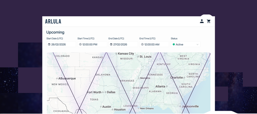
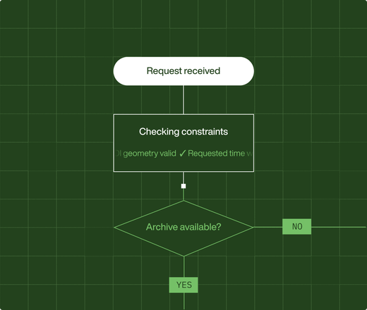
Automated satellite scheduling at any scale
Generate and maintain optimised capture schedules across single satellites or full constellations.
- Evaluate tasking requests against orbital and sensor constraints
- Resolve conflicts and capacity trade-offs automatically
- Increase utilisation without expanding scheduling teams

Secure, enterprise-scale control of spatial data
Govern access, licensing and usage across sensitive EO datasets without creating silos.
- Build a unified internal archive of spatial data assets
- Enforce fine-grained access controls at user and API level
- Maintain full auditability for defence and enterprise compliance
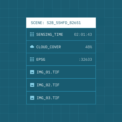
Make EO data interoperable and cloud ready
Standardise imagery and metadata at ingestion so downstream systems work reliably at scale.
- Convert imagery to STAC-based, cloud-optimised formats
- Eliminate inconsistencies across sensors and suppliers
- Ensure data is analysis-ready the moment it arrives
Sales Engine
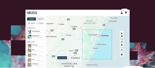
Introduction to the Sales Engine What is Sales Engine? Sales Engine is the platform used to:
Read MoreFulfillment Engine
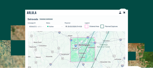
Introduction to the Fulfillment Engine The Fulfillment Engine gives large enterprise, government, and defence organisations a single, trusted interface to order, task, and receive satellite imagery across all their approved providers and sovereign assets.
Read MoreConstellation Orchestration
Introduction to Constellation Orchestration Constellation Orchestration automates how satellite operators generate, optimise, and maintain daily capture schedules across single satellites, full constellations, or multiple constellations operating together.
Read MoreAdvanced Data Management
Advanced Data Management (ADM) provides the governance, security, and control layer for managing spatial data at scale across defence, government, and enterprise environments.
Read MoreWorkflow Automation
Introduction to the Workflow Automation toolkit Automation Workflows provide the orchestration layer for building, running, and scaling geospatial data pipelines.
Read MoreData Normalization
Data Normalisation standardises raw imagery and derived products into a consistent, interoperable, and cloud-optimised format suitable for large-scale analysis and automation.
Read More